A ten-year plan to improve access for everyone to the countryside and open space around Brighton and Hove, looks set to be given the go ahead next week.

BRIGHTON & Hove City Council’s Rights of Way Improvement plan has been drawn up by the council’s parks service, following a citywide consultation earlier this year.
Councillors from the Environment, Transport and Sustainability will be asked to adopt the plan at a meeting on November 27.
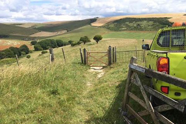
Brighton & Hove City Council is responsible for maintaining around 100 miles of public rights of way all over the city, including footpaths, bridleways and trails.
Every 10 years, the council produces a Rights of Way action plan setting out how it intends to protect and enhance this network and improve provision for walkers, cyclists, horse riders and those with mobility issues.
Since the last Rights of Way Improvement plan was adopted in 2007, nearly 1.000 acres of open access land has been created along with more than 26 miles of new public rights of way.
This includes 18.5 miles of new footpaths and bridleways, 8.5 miles of ‘Easy Access’ trails and 8 miles of multi-user paths to improve access for cyclists, horse riders and people with mobility difficulties.
In addition, between 2015 and 2017, 500 urban link footpaths (twittens) were added to the Definitive Map and nineteen obstacles removed – such as stiles replaced with gates.
The council has also resolved thirty-eight ‘missing links’ to connect existing rights of way and create more circular or varied distance routes.
The new Rights of Way Action Plan aims to build on these successes continuing to improve access for a diverse set of users and provide the information needed to make the best use of the access available.
The plan incorporates responses from the consultation which attracted one hundred and forty responses and has five main aims:
♦ To continue to improve accessibility for diverse users, including blind and partially sighted people and those with mobility issues
♦ Make information more accessible to residents and visitors, Including signage and downloadable maps and guides
♦ Improve connectivity to green spaces within the city including linking urban areas and housing estates with green space
♦ Improve links between urban areas, housing estates and green space within the city.
♦ Work with South Downs National Park and neighbouring authorities to improve access to the National Park and The Living Coast Biosphere, creating green corridors and encouraging more people to make short journeys on foot or cycle.

Cllr Gill Mitchell, chair of the Environment Committee said: “Every day hundreds of people from all over the city enjoy getting out and about, using the city’s footpaths and rights of way and enjoying out precious countryside, parks and open spaces.
“I’m extremely impressed by what has been achieved over the last 10 years, in creating new ways for everyone to access and enjoy our open space, and welcome the proposals to build on this success over the next decade.”


You must be logged in to post a comment.